BUYING LAND ON THE OREGON COAST: WHAT YOU NEED TO KNOW BEFORE YOU BUY
Purchasing real estate on the Oregon Coast requires navigating a unique regulatory framework. The state of Oregon operates under some of the most comprehensive coastal land use regulations in the United States. Understanding these specific legal and environmental restrictions prior to committing financial resources is critical to ensuring your parcel can be developed as intended.
This guide provides an objective breakdown of the state-level regulations governing coastal parcels, local zoning overlays in Clatsop County, and practical due diligence frameworks for prospective buyers.
→ See available land listings on the North Oregon Coast: saltairehomes.com/properties
→ Talk to a Saltaire agent about land purchases: saltairehomes.com/contact
Just because a land parcel exists, does not automatically guarantee a legal right to build. Overlapping state coastal goals and local municipal rules mean that many vacant lots carry permanent development hurdles. The history of a land parcel and historic restrictions that may have been placed on the land also play a role.
Buyers must verify five primary factors to confirm if a coastal parcel is buildable:
Prospective buyers must obtain the complete list of "Allowed Uses" for a property's exact zone directly from the local planning jurisdiction. In unincorporated areas of Clatsop County, verification must go directly through the Clatsop County Community Development Department. Never rely on a seller's text description or past assertions regarding land use. For properties within the city limits, the individual planning office for the city in which the lot is located will have specific zoning guidelines and be a good first call to see if there are any obvious things that you may want to consider.
The majority of rural coastal parcels located outside established city sewer systems require individual septic systems. If Buyer’s purchase of rural property is combined with the intent to build, it is advisable to complete a formal soil evaluation and percolation ("perc") test. If the soil profile fails to meet state environmental safety standards, the land cannot support a legal residential dwelling. In Clatsop County, the Clatsop County Onsite Septic Program operates via the Public Health Office. This office is physically located in Astoria and onsite septic records can be accessed on Clatsop County Webmaps. Instructions on how to access existing septic approvals can be found here, https://clatsopcountyor.civicpluswebopen.com/media/25556
Rural parcels frequently lack immediate connection infrastructure to municipal or community water systems. Developing these lots requires drilling a domestic well. The Oregon Water Resources Department must be consulted to verify existing water rights, groundwater safety, and whether new well permits are being actively issued for that specific coastal aquifer.
If a parcel exhibits seasonal standing water, a formal wetland delineation by a certified environmental scientist must be conducted prior to purchase. Developing on identified wetlands triggers strict federal regulations via the U.S. Army Corps of Engineers and state permitting via the Oregon Department of State Lands. This process can delay construction timelines by several months or completely halt development.
FEMA flood zones do not necessarily prevent development on the Oregon Coast, but they can affect how a structure must be built. Properties located within a Special Flood Hazard Area (such as AE or VE zones) are subject to local floodplain development regulations adopted by the community through the National Flood Insurance Program (NFIP).
For new construction and certain improvements, requirements may include:
In coastal high-hazard areas (VE zones), additional requirements may apply due to the risk of wave action, including specific foundation and structural design standards.
Prospective property owners should contact the local planning department to determine the applicable FEMA flood zone, Base Flood Elevation, and any floodplain development requirements before purchasing land or beginning construction. FEMA flood zone designations may also affect flood insurance requirements and costs.
In addition to elevation and construction standards, some Oregon floodplain development projects may require environmental or habitat review as part of FEMA's Endangered Species Act compliance requirements. Requirements vary by jurisdiction and project type.
Reviewing and confirming that any deeded restrictions or easements do not interfere with your intended use.
Always check with the planning office of the town or the county that the property is located. Sometimes there are restrictions that only the planning office knows about. For example, previous violations or restrictions placed on the property.
-
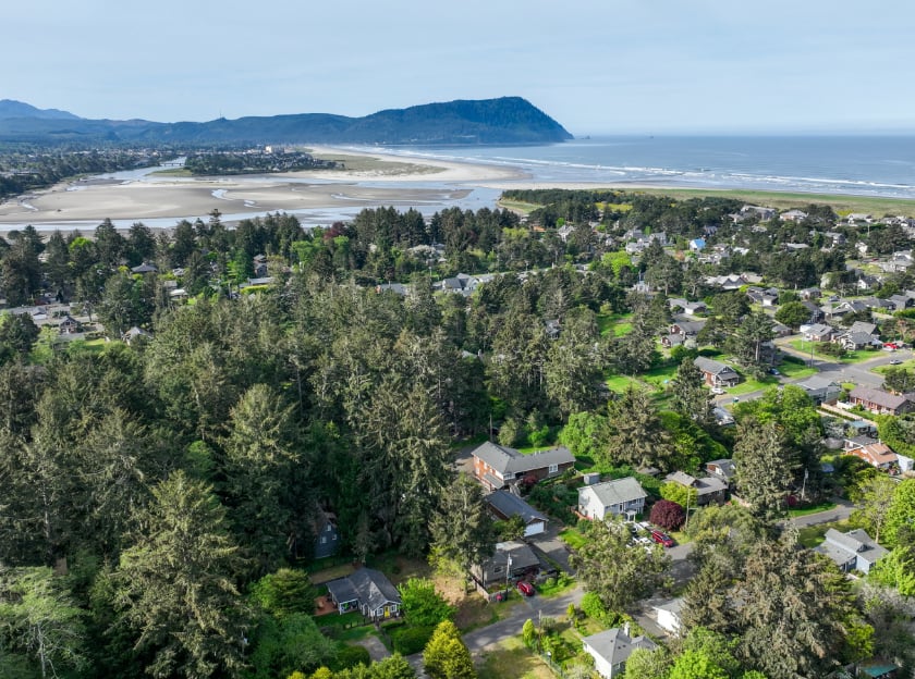
The land market in Clatsop County features diverse environments, distinct geographic characteristics, and varying price points depending on infrastructure availability:
While due diligence is still required, lots located within the city boundaries of Seaside, Gearhart, Warrenton, Cannon Beach, and Astoria present fewer regulatory hurdles. Municipal water and sewer infrastructure are generally accessible (with the exception of Gearhart that does not have public sewer) zoning parameters are explicitly defined, and permitted uses are clearly cataloged. These lots command the highest cost per square foot due to scarcity, particularly within Cannon Beach and Gearhart, where infill opportunities are highly limited.
Gated or planned developments, such as Surf Pines and Pinehurst, provide larger land tracts ranging from half an acre to multiple acres. These parcels feature dedicated community beach access and protective covenants, though they remain bound by local coastal overlay rules.
0 B Street, Gearhart | $185,000 | 4,791 Sq.Ft.
This vacant lot is just 3 blocks to town via the Ridge Path or S Cottage Ave and 5 blocks to the beach in the coveted Alphabet Streets of West Gearhart. Offering a chance to build your own beach house with all of the best of Gearhart at your doorstep. Flat topography and recently cleared, this lot is ready for your vision. Buyer to do all diligence.
→ View listing: https://0-b-st.saltairehomes.com/
36655 King Kong Ln, Astoria | $149,900 | 2.01 Acres
Positioned on high ground just off Highway 202 in rural Astoria, this 2-acre parcel is ready for your building project. With access to the Wallooskee River, the property offers an ideal setting for outdoor recreation and peaceful living. Septic approval is in place, with a drain field easement benefiting this parcel.
→ View listing: https://saltairehomes.com/properties/36655-king-kong-ln-astoria-or-us-97103-141102509
Lewis and Clark RD TL 1600, Astoria | $475,000 | 88 Acres
Own the dream with this 88-acre property with extensive, meandering Lewis & Clark River Frontage! Currently being used to graze cattle. The remains of a hay cover structure exist on the property. Located on Lewis & Clark Rd, 10 miles south of downtown Astoria. Easement in favor of this property to access the southernmost portion via lot 1602.
→ View listing: https://saltairehomes.com/properties/lewis-and-clark-rd-tl-1600-astoria-or-us-97103-210877390
Buying land requires a different due diligence process than buying a home. Here is the checklist every coastal land buyer should complete before closing:
✓ CONFIRM ZONING AND ALLOWED USES WITH THE COUNTY OR CITY PLANNING DEPARTMENT
Don't rely on the listing description. Call the planning department yourself, give them the tax lot number, and ask what is allowed.
✓ ORDER A SURVEY
Old surveys are sometimes wrong. A modern GPS survey, budgeted at $3,000–$10,000 depending on parcel size and complexity, is the only way to know exactly what you're buying.
✓ VERIFY LEGAL ACCESS
Confirm the property has documented legal access to a public road. If access depends on an easement across neighboring land, review the easement document carefully.
✓ GET A SEPTIC FEASIBILITY ASSESSMENT
A perc test before closing is something to consider. If the land can't support a septic system, it can't support a dwelling.
✓ CONFIRM WATER SOURCE AND AVAILABILITY
For a city water connection, well permit eligibility, or existing water rights, confirm which applies and what it will cost.
✓ REVIEW COASTAL OVERLAY ZONE STATUS
Ask the county planning department whether the parcel is within the Beach and Dune Overlay Zone, Coastal Shorelands designation, or any other coastal overlay.
✓ CHECK TSUNAMI AND FLOOD ZONE DESIGNATIONS
Review DOGAMI tsunami inundation maps and FEMA flood zone designation for the specific parcel.
✓ CHECK SLIDE ZONE OVERLAYS
Review DOGAMI slide zone overlays for the parcel you are interested in purchasing. In some cases, it may be required to have a geologic survey with soil samples, before a property is approved to build on.
✓ WETLAND DELINEATION IF APPLICABLE
If any portion of the parcel is located with a wetlands overlay, consider having a wetland delineation completed before closing.
✓ TITLE INSURANCE AND REVIEW
A title search will reveal any existing easements, liens, deed restrictions, or encumbrances on the property. Obtain title insurance; it's standard for land purchases in Oregon.
Q: Can I build on any land parcel on the Oregon Coast?
A: No. Oregon has some of the most stringent coastal land use regulations in the United States. Statewide Planning Goal 18 prohibits development on beaches, active foredunes, and dune areas subject to severe erosion or flooding. Many parcels that appear vacant and buildable on a map are subject to development restrictions that make construction impossible or heavily conditioned. Always confirm buildability directly with the county or city planning department before purchasing.
Q: What is Oregon Goal 18, and why does it matter for land buyers?
A: Goal 18 is Oregon's statewide planning goal for beaches and dunes. It prohibits development on beaches, active foredunes, and hazardous dune areas, and it strictly limits beachfront protective structures to areas where development existed before January 1, 1977. For land buyers, this means that oceanfront and dune-adjacent parcels may have severe development restrictions, and that any new structure built near the coast cannot later be protected by a seawall or riprap if erosion threatens it.
Q: Do I need a septic system for rural coastal land in Oregon?
A: Yes, if the parcel is outside a city sewer system, which applies to most rural coastal parcels in Clatsop County. Before closing, get a soil test and percolation (perc) test to confirm the land can support a septic system. This is a non-negotiable due diligence step. A parcel that fails the perc test cannot support a legal dwelling.
Q: What is a coastal setback, and how does it affect building?
A: A coastal setback is the minimum distance a structure must be built from the ocean shore or a defined coastal boundary. In Clatsop County, construction setback lines are established based on dune morphology, erosion rates, and other site-specific factors. Setbacks vary by location and can significantly affect where on a parcel a structure can be placed, or whether a structure can be placed at all. A Geologic Site Investigation report is required for parcels in the Beach and Dune Overlay Zone.
Q: How do I find out if a specific coastal parcel is buildable?
A: Contact the Clatsop County Community Development department (for unincorporated parcels) or the relevant city planning department (for in-city lots) with the specific tax lot number. Ask for the allowed uses under the current zoning, whether any coastal overlay zones apply, and what permits would be required to build a single-family home. This conversation, before you make an offer, is the single most important step in any coastal land purchase.
Coastal land purchases can be really complex, but our agents understand the regulatory landscape, know the Clatsop County market, and will help you ask the right questions before you commit.
→ See Available Land Listings: saltairehomes.com/properties
→ Explore the North Oregon Coast: saltairehomes.com/coastcommunities
→ Contact Saltaire Coastal Homes: saltairehomes.com/contact
DISCLAIMER:
This article is intended for general informational purposes only. Oregon coastal land use regulations are complex and subject to change. Always consult the relevant county or city planning department and a qualified real estate attorney before making any land purchase decision.
Stay up to date on the latest real estate trends.

Few things compare to waking up to the sound of the ocean and watching the sunset from your own home

Independence Day takes over the North Oregon Coast in 2026, with parades and fireworks in three towns, then a full slate of summer events carrying through to the Clats… Read more
Planning a summer escape to the Oregon Coast? Explore our Cannon Beach summer bucket list, featuring seasonal wildlife schedules, hiking suggestions and insights from … Read more
Coastal land on the Oregon Coast is some of the most regulated and can be some of the most rewarding real estate you can own. In this blog, we will teach you how to do… Read more

Seaside is one of the best family destinations on the Oregon Coast, and some of its best experiences cost absolutely nothing in 2026

The small things can make a bigger difference than most sellers expect, and they cost almost nothing compared to the potential return
You've got questions and we can't wait to answer them.