Flood Zone vs. Tsunami Zone: What Oregon Coast Homebuyers Need to Know
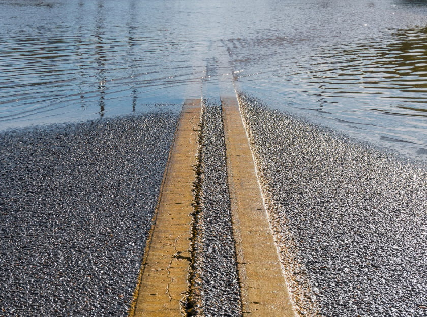
If you’re looking at homes on the Oregon Coast, you’ll probably encounter two terms: flood zone and tsunami zone. And yeah, they are not the same thing.
A home can be outside a FEMA-designated flood zone but still be inside a tsunami evacuation zone. Conversely, a property may be in a FEMA flood zone because of its proximity to a river, creek, estuary, or low-lying coastal area without being located within a tsunami evacuation area.
The good news is that neither designation automatically means you should walk away from a property. Instead, they provide valuable information about the different natural hazards that can affect a home, and the questions you should ask before purchasing.
A flood zone is a designation used primarily by the Federal Emergency Management Agency (FEMA) to identify areas with varying levels of flood risk.
FEMA's Flood Insurance Rate Maps, commonly called FIRMs, identify areas that could be affected by flooding. A Special Flood Hazard Area generally represents an area with a 1% annual chance of flooding, often referred to as the "100-year floodplain."
On the Oregon Coast, a property could have flood exposure because it sits near:
FEMA's maps include several different designations. For example, AE zones are areas where FEMA has established base flood elevations, while VE zones are coastal high-hazard areas where flooding is accompanied by additional hazards from storm-induced waves.
Flood zone information can affect several aspects of a real estate purchase.
Insurance: Properties located in certain high-risk FEMA flood zones may be subject to mandatory flood insurance requirements when financed with a federally backed mortgage.
Financing: Lenders may require documentation regarding flood risk and insurance as part of the mortgage process.
Property improvements: Floodplain regulations can affect remodeling, additions, new construction, and other improvements.
Long-term ownership costs: Flood insurance premiums and potential mitigation expenses can become part of the overall cost of owning the property.
It's also worth remembering that being outside a FEMA Special Flood Hazard Area doesn't mean a home can never flood. FEMA notes that flooding can occur outside mapped high-risk areas as well.
A tsunami zone is different. In Oregon, tsunami evacuation and inundation maps are developed by the Oregon Department of Geology and Mineral Industries (DOGAMI) to show areas that could potentially be inundated by tsunami waves.
DOGAMI's tsunami maps are based on modeled scenarios, including tsunamis generated by the Cascadia Subduction Zone and distant earthquakes. For coastal residents, this is particularly important because a local Cascadia earthquake could produce a tsunami that reaches parts of the Oregon Coast very quickly.
DOGAMI estimates that a Cascadia-generated tsunami could reach the Oregon Coast in approximately 15 to 20 minutes following the earthquake.
One of the most important distinctions for Oregon Coast homeowners is that a tsunami zone is primarily about life safety and evacuation planning.
DOGAMI's tsunami evacuation maps identify areas that could be affected by modeled tsunami inundation and show routes toward safer areas. The state maintains detailed evacuation maps for communities throughout the Oregon Coast, including areas in Clatsop, Tillamook, Lincoln, Lane, Douglas, and Curry counties.
If you are touring homes in places such as Cannon Beach, Seaside, Manzanita, Rockaway Beach, Oceanside, Pacific City, Lincoln City, Depoe Bay, Newport, or other coastal communities, knowing the property's tsunami evacuation status can be just as important as understanding its FEMA flood designation.
If you're considering buying a home on the coast, we recommend looking at both types of maps during your due diligence.
1. Check the FEMA flood designation
Find out whether the property is in a FEMA Special Flood Hazard Area and, if so, determine the specific zone. Ask about the actual FEMA designation, base flood elevation where applicable, and whether flood insurance will be required by your lender.
2. Check the DOGAMI tsunami evacuation map
Look up the property on Oregon's tsunami evacuation maps and determine whether it falls within a local or distant tsunami evacuation area. DOGAMI provides neighborhood-specific maps for communities throughout the Oregon Coast and allows users to create custom maps for specific locations.
3. Know your evacuation route
Understand where you would go after a strong earthquake, especially if you're unfamiliar with the neighborhood.
4. Ask Your Insurance Agent about insurance
Flood insurance and homeowners insurance are not interchangeable. Talk with an insurance professional about the property's specific risks and what coverage is available or required.
Q: What is the difference between a flood zone and a tsunami zone?
A: A flood zone identifies an area's potential risk of flooding from sources such as rivers, streams, coastal flooding, or other water-related events. A tsunami zone identifies areas that could potentially be inundated by tsunami waves and is primarily used for evacuation and emergency planning. On the Oregon Coast, FEMA flood maps and Oregon tsunami maps are separate tools that address different hazards.
Q: Is a tsunami zone the same as a flood zone?
A: No. A tsunami zone and a flood zone are not the same designation. A property can be in a FEMA flood zone, a tsunami evacuation zone, both, or neither. Buyers should check both types of maps when evaluating a home on the Oregon Coast.
Q: Can a house be in both a flood zone and a tsunami zone?
A: Yes. A coastal property can potentially be located within both a FEMA-designated flood-risk area and a tsunami evacuation area. These designations represent different hazards, so being in one does not automatically mean the property is in the other.
Q: Does being in a tsunami zone mean the house will flood?
A: Not necessarily. A tsunami evacuation zone represents an area that could potentially be affected by tsunami inundation under modeled scenarios. It does not mean that flooding will occur during normal weather or that a property will necessarily experience a tsunami.
Q: Does being in a flood zone mean my Oregon Coast home is at risk of a tsunami?
A: No. Flood-zone designation and tsunami-zone designation are separate. A property may be in a FEMA flood zone because of its proximity to a river, estuary, or coastal flooding area without being located within a tsunami evacuation zone.
Q: Do I need flood insurance if my home is in a tsunami zone?
A: Not necessarily. A tsunami evacuation designation does not automatically mean that flood insurance is required. Flood insurance requirements are generally associated with the property's flood-risk designation and mortgage requirements. Homebuyers should speak with their lender and insurance professional about the specific property.
Q: How do I find out if a home on the Oregon Coast is in a flood zone?
A: You can check the property's location against FEMA's current Flood Insurance Rate Maps. The property's specific flood-zone designation is important because different zones represent different levels and types of flood risk. A lender, insurance agent, or other qualified advisor can also help you understand the information.
Q: How do I find out if a home is in a tsunami zone in Oregon?
A: Oregon's tsunami inundation and evacuation maps are provided by the Oregon Department of Geology and Mineral Industries (DOGAMI). Buyers can use the maps to determine whether a property is within a modeled tsunami evacuation area and to identify nearby evacuation routes and areas of higher ground. There is also a map overlay available on Clatsop County Webmaps. https://delta.co.clatsop.or.us/apps/ClatsopCounty/
Q: What should I do if the home I want to buy is in a tsunami evacuation zone?
A: Being in a tsunami evacuation zone does not automatically mean you should avoid the property. Instead, understand the property's evacuation area, identify the nearest evacuation route, know where higher ground or a designated safe area is located, and make sure everyone in the household knows what to do following a strong earthquake or tsunami warning.
Q: How quickly could a tsunami reach the Oregon Coast?
A: A tsunami generated by a large earthquake along the Cascadia Subduction Zone could reach parts of the Oregon Coast very quickly, potentially within minutes. Because of this, residents should understand that a strong or long-lasting earthquake may serve as a natural warning to immediately move inland or to higher ground rather than waiting for an official alert.
Q: Should I avoid buying a home in a flood zone on the Oregon Coast?
A: Not necessarily. Many coastal communities include properties with some level of flood exposure. The important questions are what type of flood zone the property is in, what insurance may be required, how the property is constructed, what mitigation measures are in place, and how the risks fit your comfort level, plans and budget.
Q: Should I avoid buying a home in a tsunami zone?
A: Not necessarily. A tsunami-zone designation is primarily important for understanding evacuation and life-safety considerations. Some beautiful and desirable Oregon Coast neighborhoods are located within tsunami evacuation areas. Buyers should understand the specific evacuation map, route, and property characteristics before making a decision.
Q: Is a home outside a flood zone safe from flooding?
A: No. Being outside a FEMA-designated high-risk flood area does not mean a property can never experience flooding. FEMA notes that flooding can occur outside areas designated as higher-risk flood zones. Buyers should consider the property's drainage, elevation, history of water intrusion, nearby waterways, and other local factors.
Q: Is a home outside a tsunami zone completely safe from a tsunami?
A: No. Tsunami maps are based on modeled scenarios and are designed to support preparedness and evacuation planning. Being outside a mapped evacuation zone generally means the property is outside the modeled evacuation area for that scenario, but residents should still understand local emergency procedures and evacuation routes.
Q: What is the most important thing to know about flood zones versus tsunami zones?
A: The most important thing to remember is that a flood zone and a tsunami zone measure different risks. When buying a home on the Oregon Coast, don't rely on just one map. Review both the property's flood-risk information and tsunami evacuation information so you have a more complete understanding of the property and the surrounding community.
Stay up to date on the latest real estate trends.

What to know about post-closing occupancy agreements, seller rent-backs, timelines, costs, and protecting the buyer’s interests in an Oregon home sale.

Discover what it’s like to buy a home in Astoria, Oregon; From historic architecture and Columbia River views to local market trends, coastal weather, rental regulatio… Read more
What Oregon Coast Condo Buyers Need to Know About HOA Costs, Reserves, Assessments, and Rules

Summer's crowds thin out in September, but the coast doesn't slow down. Here's your week-by-week guide so you don't miss any event this September 2026
An honest look at daily life in Gearhart, Oregon, the beach, the golf course, and the small-town pace that keeps people coming back
If you’re looking at homes on the Oregon Coast, you’ll probably encounter two terms: flood zone and tsunami zone. And yeah, they are not the same thing.
You've got questions and we can't wait to answer them.